Lake Pontchartrain to Gulfport Fishing Chart
$27.99
Model #
13178918
Mfg #
140F
Quantity not available. Please adjust.
Temporarily Out of Stock
Thank you!
We'll let you know when it's back in stock.
-
+
Frequently Bought Together

In-Stock. Guaranteed.

In-Stock. Guaranteed.

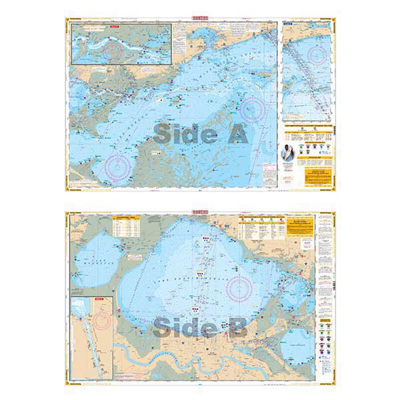
Complete coverage of Lake Ponchartrain and Lake Maurepas, through Chef Menteur Pass and the intracoastal waterway to the Rigolets and Lake Borgne. Includes Mississippi Sound and the Ship Island Area. Details for Gulfport and the Rigolets as well as the Inner Harbor Navigation Canal in New Orleans. This chart details all of the major fishing areas and pinpoints dozens of specific areas for the major species caught in the area. (Seatrout, Redfish, Flounder, Drum, Whitetrout, Jack Carvelle, Tripletail, Channel Catfish, Tarpon, Crappie, Sheepshead.) Each area where fish are found have GPS positions. Reef Ball Areas, Marsh & Grass Areas are listed as well as known bait areas. Also included is a GPS Waypoint Table. Marinas are listed as well as popular Boat Ramps.
- Dimensions: 25” x 38” ; 7” x 13” folded
Cartography
Lake Pontchartrain
Features
Waterproof
,
Double Sided
,
Fishing
Region
Gulf Coast
States
Louisiana


