
How NOAA used to do it: lithographing charts on printing presses in 1908. Today, we make Print On Demand charts to ship to you, and stock a selection of pre-printed charts in our stores. You can also download Raster Navigational Charts: NOAA RNC® and Electronic Navigational Charts: NOAA ENC® from NOAA for free. Photo: NOAA.
Paper charts are key navigational tools on nearly every vessel, even with advances in technology that make digital electronic charts affordable and convenient. They serve as a primary means to plan and record routes, an accurate backup to electronic charts, and a reliable source of information about the waters where you enjoy boating.
Print-on-demand technology now makes paper charts as up-to-date as possible, with the latest Notice to Mariners corrections and NOAA safety updates available daily. You can order print-on-demand charts online and we’ll print and ship them to you from our warehouse. West Marine also stocks traditional rolled printed charts in our stores. These do not have the most up-to-date information, but you can take them with you immediately.
- Who Creates Nautical Charts?
- Chart Selection
- Being Chart Savvy
- Free Electronic Charts from NOAA
- Paper Charts Available from West Marine
- FAQs
Who Creates Nautical Charts?
Charts of U.S. waters are created by the National Oceanic & Atmospheric Administration (NOAA), which produces digital files for more than 1,000 charts covering U.S. coastlines and major waterways, plus Coast Pilots and tide and current tables. The National Geospatial-Intelligence Agency (NGA) produces charts of international waters, lists of lights, sailing directions, sight reduction tables, pilot charts, and other publications. The Canadian Hydrographic Service (CHS) is the source for charts of Canadian waters.
Since U.S. charts are in the public domain and not subject to copyright, many private companies produce them in paper and digital form. NOAA also offers free digital downloads at nauticalcharts.noaa.gov.
Chart Selection
Print On Demand charts are printed on the day we ship them to you, so they’re as up-to-date as possible.
Consider the following when choosing a chart:
Scale: Chart scales range from large to small (1:10,000 to 1:2,000,000, for example). A large-scale chart covers a small area in great detail; a small-scale chart covers a large area with less detail. The larger the second number in the ratio, the smaller the scale and the larger the geographic area covered.
Kinds of charts:
- Sailing charts have the smallest scale and are used for ocean passages or long coastal runs. Chart 530, for example, covers the area from the Aleutian Islands to Mexico and Hawaii at a scale of 1:4,860,700 (about 1” = 77 miles) with very little detail.
- General charts are coastal cruising charts at a scale between 1:150,000 (1” = 2.4 miles) and 1:600,000 (1” = 10 miles). They show more detail than sailing charts but not enough for navigating close to shore or entering port.
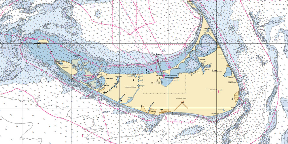
- Coast charts provide excellent detail for coastal navigation and most harbors at a scale of 1:40,000 to 1:80,000 (1” = 0.63 to 1.26 miles).
- Harbor charts show a relatively small area in great detail and are used when making port. Many include insets at a scale of 1:10,000 for critical approach areas.
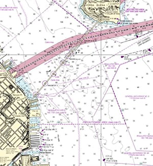
Enhanced content: Many private companies have taken core government chart data and added value. Waterproof charts are printed on synthetic paper for on-deck use and are often printed on both sides. Chartbooks compile all charts for a single region — the Intracoastal Waterway or Lake Michigan, for example — in a single convenient format. Fish and dive charts show GPS positions for reefs, fishing grounds, and wrecks.
Being Chart Savvy
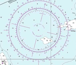
Compass rose — true direction on the outside ring, magnetic direction on the inside.
Latest editions: Charts change frequently as coastlines shift, sandbars move, and hazards are updated. Check the edition date printed at the bottom of each chart. NOAA maintains a list of the most current chart editions.
Chart catalogs: NOAA, NGA, and CHS publish free chart catalogs showing coverage areas for each chart — essential for trip planning. We have these available in our warehouses.
Chart Number 1: If you are unfamiliar with reading charts, Chart No. 1 — Symbols, Abbreviations, and Terms — explains every symbol and abbreviation used on nautical charts. Download it free:
Depth: Water depth is generally given in feet, fathoms, or meters and is measured at low water. This is a conservative measure — the actual water level will typically be higher than charted depth, giving you some margin. Always account for your vessel’s draft and any local tidal variation.
The Compass Rose: Most charts include several compass roses, oriented to the north. True direction is printed on the outer ring; magnetic direction on the inner ring. The variation — the difference between true and magnetic north at that location — is printed in the center of the rose along with the annual rate of change. Use the magnetic ring when navigating by compass; use the true ring when plotting courses on the chart with reference to geographic bearings.
Free Electronic Charts from NOAA
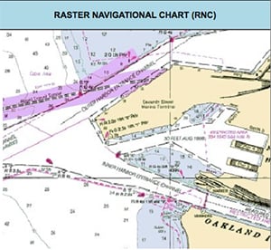
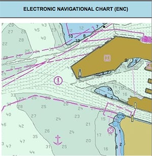
Two electronic chart formats available free from NOAA: Raster Navigational Charts (top) and Electronic Navigational Charts (bottom).
NOAA offers two types of charts for free download from nauticalcharts.noaa.gov. You can also view charts in a browser without downloading software using the NOAA Chart Viewer.
Raster Navigational Charts (NOAA RNC®) are full-color digital images of NOAA paper charts, compatible with most marine navigation software.
- Familiar appearance to paper chart users
- Compatible with RCDS software, integrating real-time GPS with chart image
- Can be updated with weekly raster patches
- No inherent safety warning capability
- Does not display denser data when zooming in
- Cannot suppress specific charting features
Electronic Navigational Charts (NOAA ENC®) are vector cartography, the same format used by Garmin BlueCharts, Navionics, C-Map, and most modern chartplotters.
- Vector database format with layered attribution for each chart feature
- Categories of data can be suppressed by software (show only depth contours, for example)
- Zooming in reveals denser data rather than just enlarging the image
- Chart image can be rotated and text remains upright
- Electronic chart systems can issue warnings of impending hazards
- Different appearance from paper charts — requires some adjustment for paper chart users
Paper Charts Available from West Marine
Print-On-Demand by OceanGrafix
Print-On-Demand charts provide the latest updated information and have become the standard for timely accuracy. They include all the latest local and regional Notices to Mariners corrections, accurate at the time of printing. Because coastlines gradually change, sandbars move, storms rearrange submerged hazards, and the government regularly updates regional information, this guaranteed up-to-date accuracy adds a meaningful level of safety for mariners. These charts are approved by NOAA, meet USCG carriage requirements for commercial vessels, and are SOLAS compliant.
Full-size Print-On-Demand charts are single-sided, either 36” or 42” wide and between 36” and 60” in length. They include added safety information, boating tips, and emergency procedures, and are printed on heavy-duty water-resistant paper. Order online and they are printed and shipped directly to you.
Standard Paper Charts
The government discontinued printing lithographic nautical charts as of April 13, 2014. However, some private companies now produce standard paper charts, and West Marine stocks them in our stores. If you need a local chart right now, we may have what you are looking for at your nearest store.
Frequently Asked Questions
Do I need a paper chart if I have a chartplotter?
Yes — and maritime regulations often require one. USCG regulations for commercial vessels have specific chart carriage requirements, and even for recreational vessels, a paper chart is strongly recommended as a backup to electronic navigation. Electronic chartplotters fail, lose power, or become unreadable in direct sunlight. A paper chart is unaffected by any of these problems. It also provides a broader overview of your area that a chartplotter screen rarely shows clearly, and is far superior for route planning at the table before you leave the dock.
What is the difference between a large-scale and a small-scale chart?
This is one of the most consistently confusing concepts in chart navigation. A large-scale chart (like 1:10,000) shows a small geographic area in great detail — typically a single harbor. A small-scale chart (like 1:1,200,000) shows a large geographic area with much less detail — a stretch of coastline or an ocean passage. The number after the colon is the key: a larger number means a smaller scale and a larger area shown. Most boaters need at least two chart scales: a coast or harbor chart for navigation near shore, and a general chart for planning and offshore passages.
What is the difference between RNC and ENC charts?
An RNC (Raster Navigational Chart) is essentially a digital photograph of a paper chart. It looks familiar but cannot display more data when you zoom in — it just gets bigger, like enlarging a photo. An ENC (Electronic Navigational Chart) is a vector database where each chart feature has layered data. Zooming in reveals denser information, data layers can be selectively shown or hidden, and the system can issue automatic warnings when you approach a hazard. ENCs are the format used by virtually all modern chartplotters. Both are available free from NOAA.
How often should I update my paper charts?
Whenever corrections affect the waters you navigate. NOAA publishes weekly Notices to Mariners listing chart corrections. Print-on-demand charts incorporate all corrections current at the time of printing, so ordering a new print-on-demand chart is the simplest way to ensure currency. For standard paper charts, check the NOAA current editions list against your chart’s edition date. Charts covering active shipping channels, frequently dredged inlets, and areas with recent storm activity may need more frequent updating than charts of stable offshore waters.
What is magnetic variation and why does the compass rose show two rings?
Magnetic variation (also called magnetic declination) is the angular difference between true north (the geographic North Pole) and magnetic north (where a compass needle actually points). This difference varies by location and changes slowly over time. The outer ring of the compass rose shows true directions; the inner ring shows magnetic directions. When plotting a course on the chart, use the true ring and then apply variation to get the magnetic heading you will steer by compass — or use the magnetic ring directly. The variation for the chart area is printed in the center of the rose, along with the annual rate of change so you can calculate current variation if the chart is older.