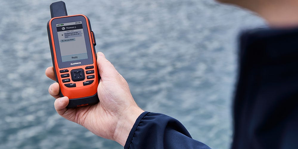
The Global Positioning System (GPS) helps your smartphone determine your location, powers countless navigation and mapping apps, and enables your boat's chartplotter and AIS system to display your position and nearby vessels. Beyond navigation, GPS supports a wide range of industries, including agriculture, mining, construction, surveying, transportation and supply chain management. In this article, we'll explain how GPS works and help you choose the right GPS solution for your boat.
- How GPS Operates
- Why You Should use a Handheld GPS Instead of a Smartphone
- Optional Maps with More Detail
- VHF Radios with GPS Included
- Connecting to Other Global Satellite Navigational Systems
How GPS Operates
The Global Positioning System (GPS) is a satellite-based navigation system that provides accurate position information 24 hours a day, on land, at sea and in the air, in virtually any weather, without a subscription or user fee. Developed for the U.S. Department of Defense between 1978 and 1994, GPS is built around a nominal constellation of at least 24 satellites in medium Earth orbit, approximately 12,550 miles (20,200 km) above the Earth's surface, although significantly more satellites are typically in service. Today, this multi-billion-dollar system is freely available to civilian users around the world.
GPS receivers calculate your position by receiving precisely timed radio signals from multiple satellites orbiting the Earth approximately every 12 hours. Each satellite continuously broadcasts its exact orbital position and a highly accurate time signal generated by an onboard atomic clock. By measuring how long it takes signals from at least four satellites to reach the receiver, a GPS unit can determine your location, typically to within a few meters under open-sky conditions.
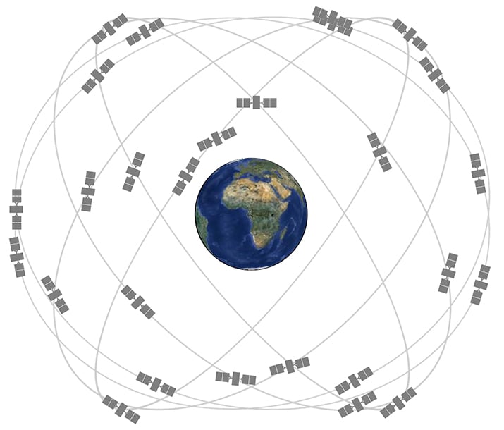
The GPS constellation contains several generations of working satellites, plus spares in case of failure. (Photo: GPS.gov.)
GPS receivers need to locate three satellites in order to calculate a two-dimensional position, and can develop a three-dimensional fix when they receive signals from four satellites.
Since, in theory, four satellites are “in view” from every location on Earth, problems with reception are caused by buildings, mountains and forests blocking the line-of-sight signals.
Modern GPS satellites transmit navigation signals on multiple radio frequencies. Most civilian GPS receivers use the L1 frequency (1575.42 MHz), while newer multi-band receivers can also use L2 and L5 signals to improve accuracy, reliability and resistance to interference. Until May 2000, the U.S. Department of Defense intentionally reduced the accuracy of civilian GPS through a program called Selective Availability, which was designed to limit its military value to potential adversaries. When Selective Availability was discontinued, civilian GPS accuracy improved dramatically.
WAAS Improves the Accuracy of the System
The Wide Area Augmentation System (WAAS), developed by the Federal Aviation Administration (FAA), improves the accuracy, reliability and integrity of GPS positioning. WAAS corrects for errors caused by satellite clock and orbit variations, as well as signal delays created as GPS signals pass through the Earth's atmosphere. It also continuously monitors the health of GPS satellites and alerts users when a satellite should not be used for navigation.
WAAS uses a network of precisely surveyed ground reference stations across North America to monitor GPS signals and calculate correction data. These corrections are sent to geostationary satellites, which rebroadcast them to compatible GPS receivers. Most modern marine GPS receivers support WAAS automatically, improving position accuracy to within a few meters under good reception conditions.
WAAS is designed primarily for North America, where its ground reference stations provide the data needed to generate correction messages. Reception is generally best when the southern sky is unobstructed because the geostationary WAAS satellites remain low above the southern horizon for much of the United States and Canada. For boaters and other users in open areas, WAAS provides a simple way to improve GPS accuracy without additional equipment or subscription fees.
Why You Should use a Handheld GPS Instead of a Smartphone
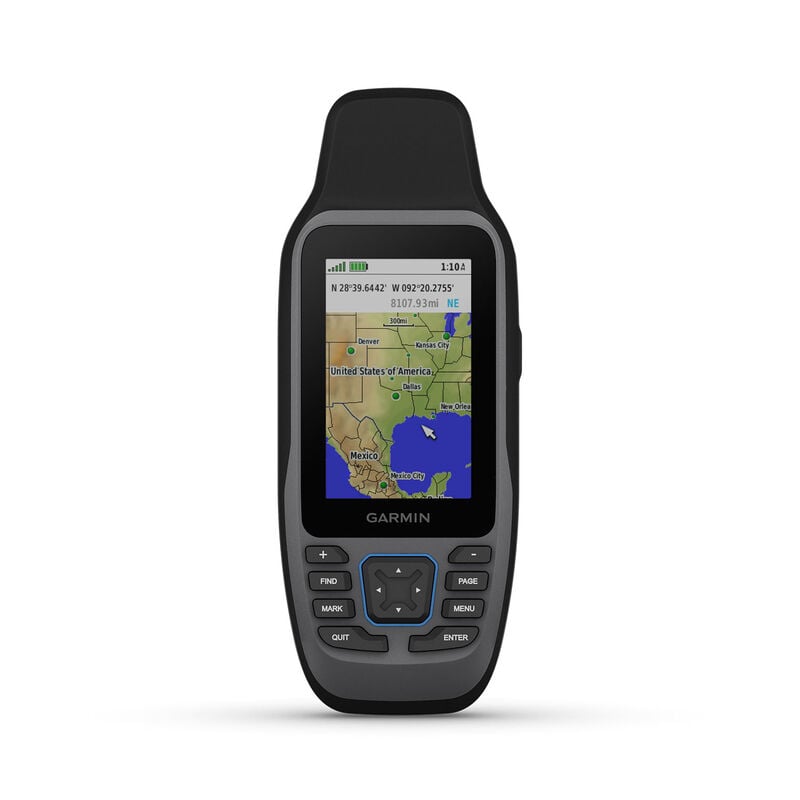
A handheld GPS like a the Garmin GPSMAP® 79sc is a must have for any boater and is a great backup for other GPS systems onboard.
Although smartphones include excellent GPS capabilities, a dedicated handheld GPS receiver remains a smart choice for boaters, hikers, geocachers and anyone who needs a rugged, waterproof navigation device. For small-boat outings, dinghy sailing or backcountry adventures, a pocket-sized handheld GPS is easy to carry and provides a reliable backup if your boat's electrical system fails or your smartphone is damaged or runs out of power.
While you can use an iPhone or Android smartphone for navigation, a handheld GPS offers several important advantages:
If you're ready to step up to a fixed-mount navigation system, today's chartplotters offer larger displays, built-in charts and advanced features such as sonar, radar and AIS integration. Many models are available with or without a transducer, allowing you to choose the sonar setup that best fits your boat.
- Replaceable batteries: Continuous GPS navigation can quickly drain a smartphone battery, especially when the screen remains on. Most handheld GPS receivers operate on standard AA batteries or rechargeable battery packs, making it easy to restore power even when you're away from shore.
- Built for the outdoors: Handheld GPS receivers are designed for harsh environments, with waterproof, impact-resistant housings that can withstand rain, spray and rough handling. While many modern smartphones are water resistant, they generally aren't as rugged as a purpose-built handheld GPS.
- Navigation without cellular service: GPS works anywhere with a clear view of the sky and does not require a cellular connection. Although smartphones can also receive GPS signals without cell service, many navigation apps require maps to be downloaded in advance. Handheld GPS receivers store their maps onboard, so they're always available when you need them.
- Always-available mapping: With maps stored in internal memory or on a microSD card, a handheld GPS displays charts even when you're far beyond cellular coverage or Internet access.
Many boats larger than an aluminum outboard skiff will also have a fixed-mount GPS device. These take the form of a chartplotter, fishfinder/GPS combo or multifunction network display. For help choosing one of these devices for your boat, check out our West Advisor on Selecting Networked Marine Electronics
Non-mapping GPS receivers: All GPS receivers other than the most basic handhelds feature electronic maps, so you can see your position on a detailed chart. If you only want to get position fixes and navigate using just traditional paper charts, a receiver like the Garmin GPS 73 will provide that capability, and will let you plan routes with a collection of waypoints. A few larger fishfinders like the Garmin Striker™ series likewise include non-mapping GPS as sort of a bonus. They’ll help you return to a great fishing location or your home port, but will not let you add maps.
GPS with a basemap only: Most handheld GPS units are pre-loaded with a “basemap”, with varying levels of detail depending on the individual receiver. Basemaps usually show crude, blocky representations of geography. Luckily, many of these economy-grade GPS receivers allow you to add more detailed maps.
Optional Maps with More Detail
To take full advantage of a GPS receiver's navigation capabilities, you'll want detailed electronic charts designed for marine, automotive, off-road or backcountry use. These moving maps display your position directly on the chart, making it easier to navigate, plan routes and identify nearby hazards and points of interest. Depending on the receiver, chart data is provided in one of two ways::
Pre-loaded charts: Many GPS receivers come with maps or charts stored in their internal flash memory. Some include detailed regional or nationwide chart coverage, while others include only a basic worldwide basemap that shows major coastlines, highways and geographic features. Additional chart regions can often be added, depending on the model.
Maps on a microSD card: Many GPS receivers allow you to add detailed chart data using a microSD card. Marine charts from providers such as C-MAP, Navionics and Garmin BlueChart can be purchased for specific regions and installed as needed, making it easy to expand coverage when you travel to new cruising areas.
Many Garmin handheld GPS receivers support detailed charts stored on microSD cards, which are small, removable memory cards that make it easy to add or update chart coverage. Depending on the receiver, compatible Garmin BlueChart® marine charts and other map products can be installed for specific regions. For more information about selecting electronic charts for your GPS receiver or chartplotter, see our West Advisor article, Selecting Electronic Cartography.
VHF Radios with GPS Included
We offer several handheld VHF radios that include a GPS receiver, adding navigation capability to common boating communication device.
Handheld VHF radios with Digital Selective Calling and GPS: Premium handheld VHF radios now include a GPS receiver, which you can use for navigation, providing your Lat/Long position and allowing you to navigate to stored waypoints. These VHF/GPS combo handhelds include Digital Selective Calling (DSC), which functions as a sort of VHF-frequency emergency beacon. For more about handheld VHF radios with or without GPS, go to our article on Selecting a VHF Handheld Radio.
Connecting with other Global Satellite Navigation Systems
Other nations have built or are launching their own satellite navigation systems. The Russian Global Navigation Satellite System (GLONASS) is fully operational worldwide. There are also the Indian Regional Navigation Satellite System, the Japanese Quasi-Zenith Satellite System covering Asia and Oceania, the Chinese BeiDou-2tf system, and the European Union's Galileo. Today, many receivers simultaneously use GPS, Galileo, GLONASS and BeiDou.
Conclusion
The U.S. military invested billions of dollars building Navstar (the original official name for the GPS system) for military purposes and created the world’s greatest navigation system for civilian use as an afterthought. Okay, it did cost $14 billion to create the system and launch the satellites, but now we get to use the satellites essentially for free.
Browse All Marine Electronics & Navigation Gear
- Chartplotters, GPS units, radar systems, and integrated navigation displays
- Sonar, CHIRP, downscan, and fish-finding electronics
- Marine stereos, speakers, amplifiers, and audio accessories
- VHF radios, AIS, satellite communication equipment
- Autopilot systems and steering control components
- Wind, depth, speed, and multifunction instruments
- Marine binoculars for navigation and low-light use
- Thermal and night-vision devices for situational awareness
- Onboard monitoring and security systems
- Magnetic and electronic compasses
- Paper and electronic navigation charts
- Regional cruising and harbor guides
- Traditional navigation plotting tools


