C-MAP Reveal: Florida and the Bahamas High-Definition Maps (Micro SD Card)
C-MAP Reveal: Florida and the Bahamas High-Definition Maps (Micro SD Card)
Model #
19611136
Mfg #
M-NA-Y643-MS
$299.99
Model #
19611136
Mfg #
M-NA-Y643-MS
Quantity not available. Please adjust.
Temporarily Out of Stock
Thank you!
We'll let you know when it's back in stock.
-
+
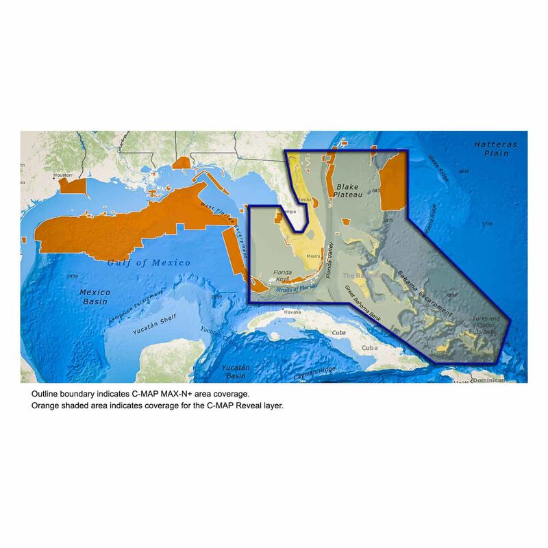
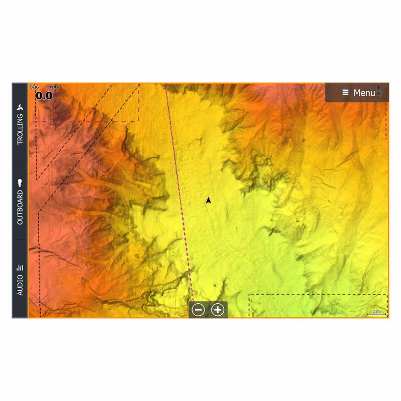
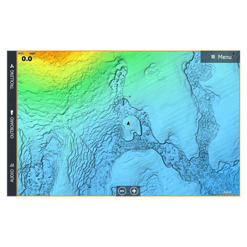
C-MAP® Reveal charts help anglers and divers save time on the water, finding key areas faster with the high-definition views of structure, wrecks and contour changes on the sea floor.
The high-detail C-MAP® Reveal imagery replaces shaded relief data in selected areas with more accurate depth variations, revealing the best fishing and diving spots. C-MAP Reveal charts include C-MAP HRB Coastal Data, Genesis social map data and satellite imagery that can be overlaid on top of the standard vector charts used for navigation. The C-MAP Reveal layer is activated by turning on the Shaded Relief setting and is available for use on Lowrance®, Simrad® and B&G® chartplotters.
Features:
- High-definition C-MAP Reveal layer on selected areas around Florida and the Bahamas including detailed marina and port plans
- Reduces search time with immediate high-definition display of bottom structure, wrecks, isolated reefs and ledges
- Easy to use – just turn on Shaded Relief setting in chartplotter
- C-MAP Reveal charts contain full C-MAP MAX-N+ vector navigation data, including new features like High Resolution Bathemetrics, Custom Depth Shading, Genesis layer and satellite imagery
Card Type
C-Map
Cartography
C-MAP Reveal: High Definition
Type
Electronic Charts


