GPSMAP 1222 Plus Multifunction Display with Worldwide Basemap Charts
PLUS Plan includes:
- Wear and Tear Coverage
- Power Surge Protection
- Exchange for products under $400
- Onboard service on products over $750
- Up to 5 years of total coverage
PLUS plan goes into effect with purchase; no registration required. Purchase online, in stores or call 1 (800) 262-8464.
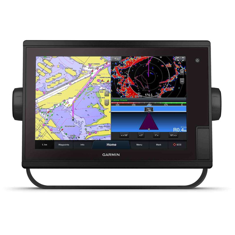
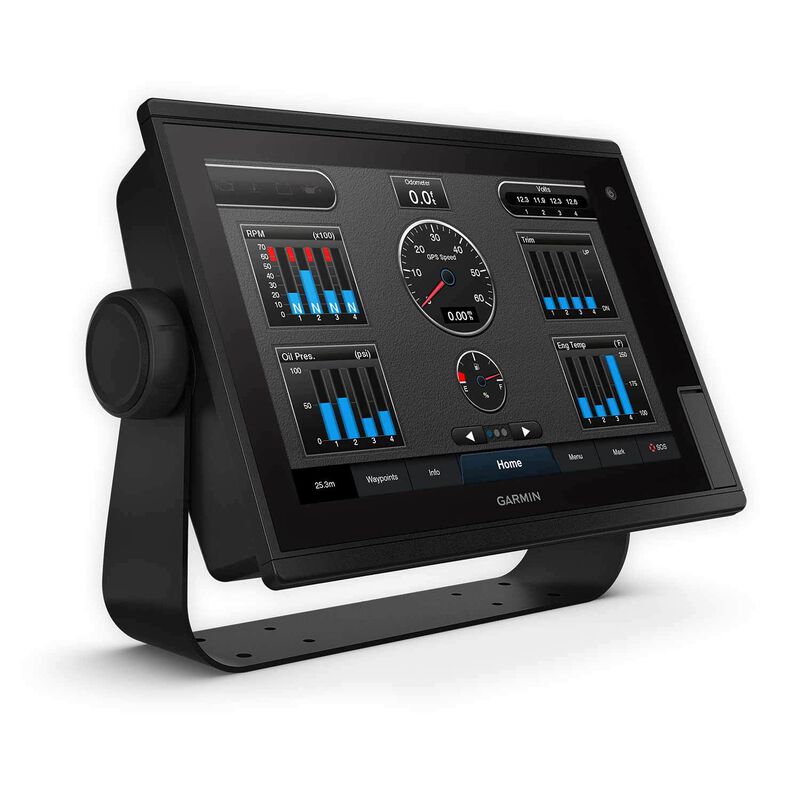
The bright, sunlight-readable 12” intuitive touchscreen chartplotter is easy to use in any environment and seamlessly integrates into your Garmin marine system.
- Easily integrate with more engines
- Connect to your favorite third-party devices
- Easily build your marine system using the best of network connectivity
- Compatible with premium maps and charts for the best in Garmin navigation
- Take the guesswork out of sailing with clear laylines and more right on the screen
- Manage your marine experience from nearly anywhere
Garmin SailAssist™ Sailing Features
View laylines, race start line guidance, enhanced wind rose, heading and course-over-ground lines, true wind data fields and tide/current/time slider, wind angle, set and drift, wind speed and more.
Optional BlueChart® G3 Vision® Charts
These optional charts offer the best of Garmin and Navionics® data, Auto Guidance technology and other premium navigation features*.
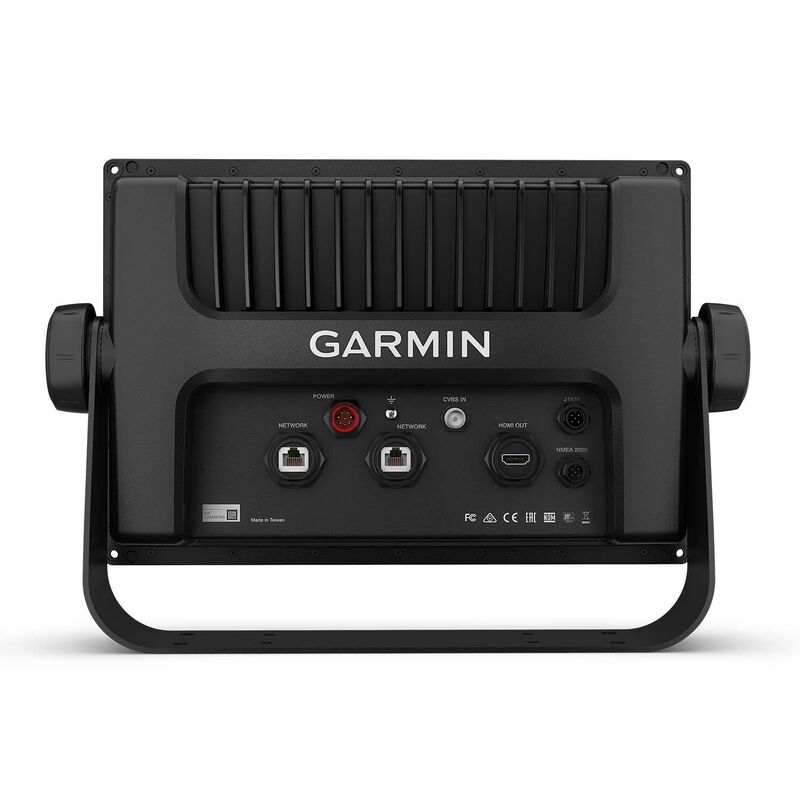
Garmin Marine Network
If you have multiple Garmin devices on your boat, you can share information — such as maps, user data, radar and IP cameras — among them.
NMEA 2000® and NMEA 0183 Networks
Connect to autopilots, digital switching, weather, FUSION-Link™ audio system, media, VHF, AIS and more from one screen.
ActiveCaptain® App
Built-in Wi-Fi® connectivity pairs with the free all-in-one mobile app for access to the OneChart™ feature, smart notifications2, software updates, Garmin Helm, Garmin Quickdraw™ Community data and more.
Integrated ANT® Technology
Connect with some of your favorite devices, such as quatix® marine watches, gWind™ Wireless 2 transducers, GNX™ Wind marine instruments and wireless remote controls.
J1939 Connectivity
Now you can connect your chartplotter to different kinds of engines, including Yamaha engines.
OneHelm™ Feature
This exclusive feature brings together all the operations and capabilities of third-party devices, such as EmpirBus™ digital switching, on one screen.
Panoptix™ Sonar Support
Pair with Panoptix or Panoptix LiveScope™ easy-to-interpret live sonar (transducer sold separately) to see all around your boat in real time.
In the Box:
- GPSMAP 1222 Plus chartplotter
- Power cable
- NMEA 2000 T-connector
- NMEA 2000 drop cable (2 m)
- Bail mount kit with knobs
- Flush mount kit with gasket
- Protective cover
- Trim piece snap covers
- Documentation
*Auto Guidance is for planning purposes only and does not replace safe navigation operations


