Fishing & Diving Charts
$27.99
Model #
6908297
Mfg #
48
Quantity not available. Please adjust.
Temporarily Out of Stock
Thank you!
We'll let you know when it's back in stock.
-
+
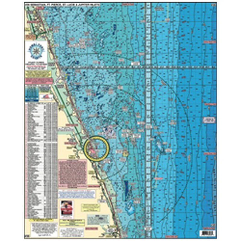
Home Port Charts offer the most comprehensive fishing and diving charts available. Covering the East Coast from New York to North Carolina and Central Florida to the Keys and Bahamas, Home Port Charts show you more information than any chartplotter can. Easy to read and understand, the laminated, colorful Home Port Charts map out everything from shoals and danger zones to bridges, depth contours, channels, underwater canyons and fishing areas.
Home Port Charts descriptively map out oceans, rivers, bay and intracoastal waterways (ICW). Offshore charts display bottom structure and productive deep water fishing areas. All charts are two-sided.
Cartography
Northern Swordfish Deep Drop Tuna
Features
Diving
,
Fishing
,
Waterproof
States
Florida


