Maptech® NOAA Recreational Waterproof Chart-Annapolis Harbor, 12283
Maptech® NOAA Recreational Waterproof Chart-Annapolis Harbor, 12283
Model #
16630394
Mfg #
12283WP-REC
$32.99
Model #
16630394
Mfg #
12283WP-REC
Quantity not available. Please adjust.
Temporarily Out of Stock
Thank you!
We'll let you know when it's back in stock.
-
+
Frequently Bought Together

In-Stock. Guaranteed.

In-Stock. Guaranteed.


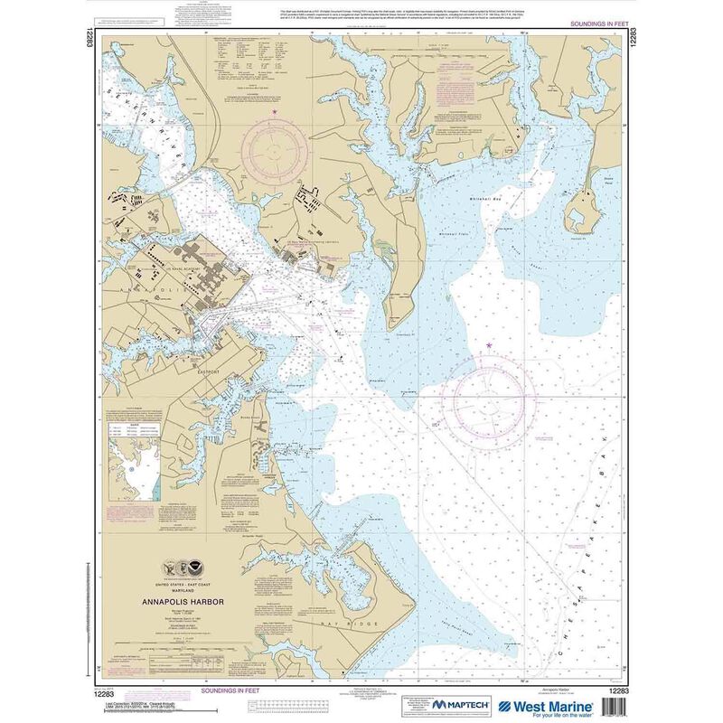
12283, Maptech® NOAA Recreational Waterproof Chart-Annapolis Harbor. Maptech® NOAA recreation charts are ideal for use aboard recreational (non-commercial) vessels. Printed on durable waterproof plastic. Accurate and up to date — usually printed after you order is placed. Maptech® NOAA charts use traditional NOAA chart colors which also makes them the perfect choice for framing and decorative purposes.
Cartography
Annapolis Harbor
Features
Waterproof
Region
Atlantic Coast
Scale
1:10000
States
Maryland


