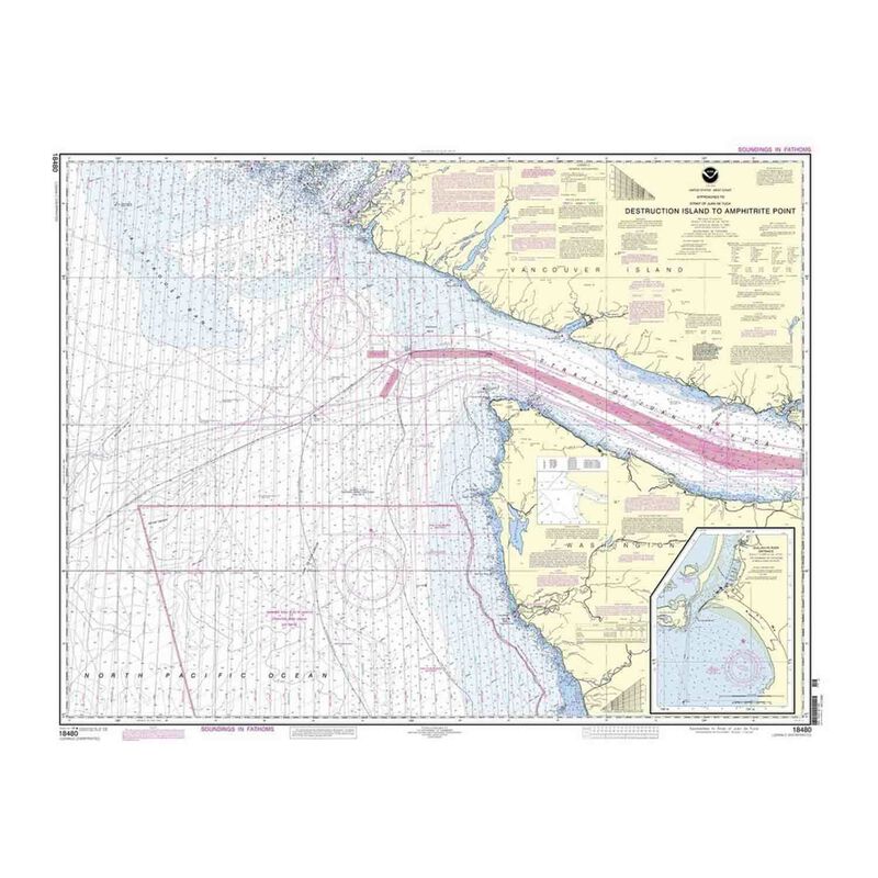
Recreational Waterproof Chart - Approaches to Strait of Juan de Fuca Destruction lsland to Amphitrite Point
Recreational Waterproof Chart - Approaches to Strait of Juan de Fuca Destruction lsland to Amphitrite Point
Model #
16630634
Mfg #
18480WP-REC
$24.99
Model #
16630634
Mfg #
18480WP-REC
Quantity not available. Please adjust.
Temporarily Out of Stock
Thank you!
We'll let you know when it's back in stock.
-
+
Waterproof charts are printed on-demand using the most recent National Oceanic and Atmospheric Administration (NOAA) data. Coast survey reviews charts weekly and applies all critical corrections specified in notices to mariners. All corrections to date are incorporated in these print-on-demand charts. Printed on waterproof, tear-resistant material using state-of-the-art printing technology. Clean, crisp colors render a frame-quality, durable chart. Printed by Paradise Cay Publications, Inc., a NOAA-certified print-on-demand partner. Charts meet United States Coast Guard carriage requirements.
- 35" x 44"
Cartography
Strait of Juan de Fuca Destruction lsland
,
Amphitrite Point
Region
Pacific Coast
Scale
1:176253
States
Washington


