Lake St. Clair Fishing Chart
Clearance
$19.91
Price reduced from
$27.99
to
Model #
11849932
Mfg #
29F
5X Points for all West Advantage Members.
Not a member? Sign up today.
Clearance offer reflects an additional 50% off the lowest price for in-store pick up only.
Quantity not available. Please adjust.
Temporarily Out of Stock
Thank you!
We'll let you know when it's back in stock.
-
+
Frequently Bought Together
In-Stock. Guaranteed.

In-Stock. Guaranteed.


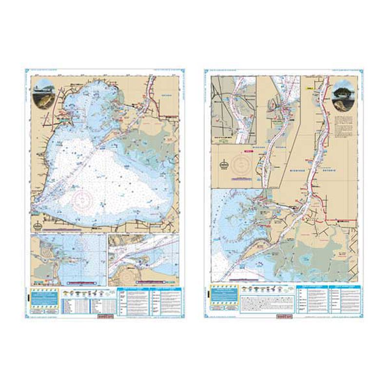
Complete coverage of Lake St. Clair on side "A" with detailed insets of the Detroit River entrance and the entrance to the Clinton River. Side" B" has complete coverage of the St. Clair River north to Lake Huron with a detailed inset of Port Huron. Nautical information derived from 3 NOAA Charts; 14852, 14853 & 14850.This large print Lake Chart details all of the major fishing areas and pinpoints dozens of specific areas for the major species caught in the area. (Large and Smallmouth Bass, Yellow Perch, Walleye, Muskie, Northern Pike, Salmon & Trout). Many areas have GPS positions. In addition many popular restaurants are listed as well as popular boat ramps.
- Two sided
- Dimensions: 25" x 38" ; 7" x 14" folded
Cartography
Lake St. Clair and St. Clair River
Features
Double Sided
,
Fishing
,
Waterproof
Region
Inland Lakes
States
Michigan


