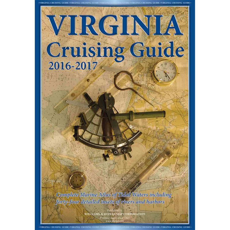
2016-17 Virginia Cruise Guide
$44.99
Model #
17565938
Mfg #
16-17 VACRGD
Quantity not available. Please adjust.
Temporarily Out of Stock
Thank you!
We'll let you know when it's back in stock.
-
+
Complete Marina Atlas of Virginia Tidal Waters, including forty-four detailed insets of rivers and harbors.
PRINTED IN THE USA
Williams and Heintz printed the very first Guide for Cruising Maryland Waters beginning in the early 1960's for the Maryland Department of Natural Resources. A few years later, we began to publish guides to cruising Virginia Tidewaters. Now, we publish it under the title of Virginia Cruising Guide. This complete chartbook includes over 50 insets of rivers and harbors. Charts 12 through 37 are at a scale of 1:80,000. The insets are in various scales from 1:40,000 to 1:20,000.
Included in your purchase of the new printed chart book, is a digital download of each individual chart. Now you can have the Williams & Heintz Cruising Guides on your iPhone, iPad, or Android phone too.
Our Virginia Cruising Guide covers Tidewater Virginia, southern Chesapeake Bay, Potomac River and the Atlantic Ocean shores and bays. There are full page enlargements of Ocean City and Chincoteague Island.
Nautical Chart books to navigate the waters of the Chesapeake Bay, Potomac River, Chincoteague Bay, Tidewater Virginia and Maryland.
- Our Cruising Guides contain the latest information on buoys, water depth, tidal currents, marinas, ramps, and channels.
- We compile navigation information from the latest National Oceanic and Atmospheric Administration (NOAA) sources.
- The chart books are red-light readable and include a planning chart, tidal currents, course headings, towing services, and a marina index.
- We use a special Wet Strength paper. This paper is fully functional even when wet.
- Each chart book is enclosed in a heavy-duty vinyl sleeve to protect it from spray.
- Personalized custom charts are available on wet strength paper, and in large print.
- Family owned and operated since 1921, Williams & Heintz Map is a local manufacturer, with four generations of boating knowledge and experience.
- We update and republish every 2 years for the most up-to-date navigation chart books of Maryland and Virginia!
- The new 2016-2017 chart books come with come with links to take you to an App, so that you can have the Williams & Heintz Cruising Guides on your iPhone, iPad, or Android phone too.
- Individual charts can be purchased separately from PDF Maps from I-Tunes or Google Play.
- Personalized custom charts are available for print on wet strength paper, and in large print.
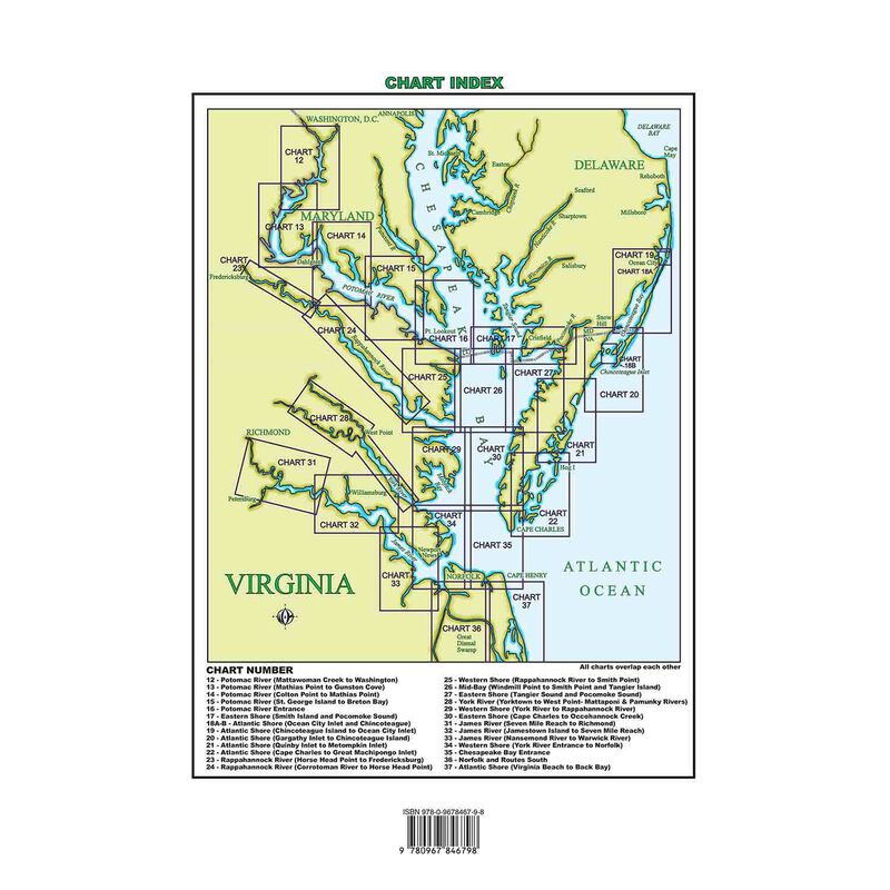
VIRGINIA CHART INDEX
12 – Potomac River (Mattawoman Creek to Washington)
13 – Potomac River (Mathias Point to Gunston Cove)
14 – Potomac River (Colton Point to Mathias Point)
15 – Potomac River (St. George Island to Breton Bay)
16 – Potomac River Entrance
17 – Eastern Shore (Smith Island and Pocomoke Sound)
18A-B – Atlantic Shore (Ocean City Inlet and Chincoteague)
19 – Atlantic Shore (Chincoteague Island to Ocean City Inlet)
20 – Atlantic Shore (Gargathy Inlet to Chincoteague Island)
21 – Atlantic Shore (Quinby Inlet to Metompkin Inlet)
22 – Atlantic Shore (Cape Charles to Great Machipongo Inlet)
23 – Rappahannock River (Horse Head Point to Fredericksburg)
24 – Rappahannock River (Corrotoman River to Horse Head Point)
25 – Western Shore (Rappahannock River to Smith Point)
26 – Mid-Bay (Windmill Point to Smith Point and Tangier Island)
27 – Eastern Shore (Tangier Sound and Pocomoke Sound)
28 – York River (Yorktown to West Point- Mattaponi & Pamunky Rivers)
29 – Western Shore (York River to Rappahannock River)
30 – Eastern Shore (Cape Charles to Occohannock Creek)
31 – James River (Seven Mile Reach to Richmond)
32 – James River (Jamestown Island to Seven Mile Reach)
33 – James River (Nansemond River to Warwick River)
34 – Western Shore (York River Entrance to Norfolk)
35 – Chesapeake Bay Entrance
36 – Norfolk and Routes South
37 – Atlantic Shore (Virginia Beach to Back Bay)
Author
Williams & Heintz
Cartography
Virginia
Edition
28th Edition
Features
Saddle Stitch Paperback
,
Digital Download

