The Canyons Fishing Chart
Clearance
$3.95
Price reduced from
$27.99
to
Model #
13178926
Mfg #
164F
Clearance offer reflects an additional 50% off the lowest price for in-store pick up only.
Quantity not available. Please adjust.
Temporarily Out of Stock
Thank you!
We'll let you know when it's back in stock.
-
+
Frequently Bought Together
In-Stock. Guaranteed.


In-Stock. Guaranteed.

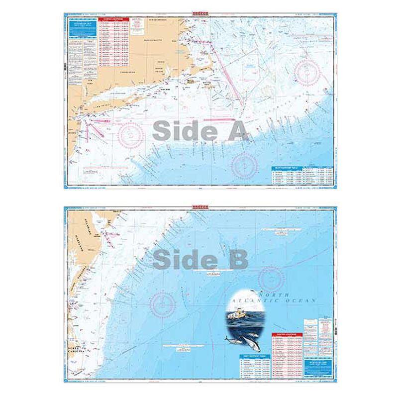
If you're an Offshore Fisherman that targets big fish then this is the chart for you!
This chart targets the Canyons from MA to NC. Side "A" lists 24 Canyons starting with Georges Canyon to Toms Canyon. Canyons are listed by name with latitude and longitude coordinates. Also included are known fishing areas such as Rodgers Basin, Franklin Basin, Mayo Swell, Cultivator Shoal and many others. In addition to the Canyons there are 16 inlet waypoint locations that are listed by name and position.Side "B" continues south from the Hudson Canyon to Keller Canyon.
- 22 Canyons listed by name and GPS coordinates
- Dimensions 25" x 38"
Cartography
George Canyon to Toms Canyon
Features
Waterproof
,
Double Sided
,
Fishing
Region
Atlantic Coast
States
Massachusetts to North Carolina


