Vulcan 9 FS Chartplotter with US C-MAP MAX-N Charts



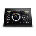
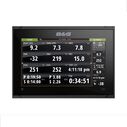
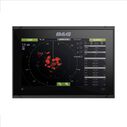
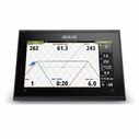
The B&G Vulcan9 FS Display is a powerful all-in-one Chartplotter and depth sounder for mid sized sail boats.
It includes an SD card with C-MAP chart of continental USA that offers excellent coastal charting with tidal data, harbor info, high-def contours, Active Captain information and C-MAP Easy Routing™ and other features.
Vulcan9 FS incorporates B&G's forward looking collision avoidance sonar technology for safe passage making in areas where chart accuracy is uncertain. Vulcan9 includes B&G HALO 20 and HALO20+ Radar support giving the user ultimate situational awareness for passage making at night and in poor weather. Vulcan9 will also connect to B&G sailing instruments and autopilot systems for a fully integrated electronics package.
No physical buttons and low profile mounting options makes Vulcan9 one of the cleanest and most integrated looking navigation device for aftermarket installs. Combine this with an extensive set of advanced sailing software features inherited from it’s bigger brother, the Zeus3s, and the Vulcan 9 is the go-to standalone navigation display for the aspiring sailor.
Easy to use multi-touch user interface
- Glass dash styling
- Super bright widescreen display
- Radar integration
- Built in Wi-Fi connectivity
- Built in 10 Hz, high sensitivity GPS antenna
- Dual Micro SD card slots
- Built in echosounder (Broadband & Chirp)
- Built in ForwardScan sonar(Transducer sold seperately)
Advanced NMEA2000 networking
- BEP CZone integration
- Fusion Link and sonicHub2 Audio Support
- AIS SARTs
- NMEA Data Logging
- GRIB Weather Support
- H5000 system integration
- SailSteer, Laylines with Sailing Time, WindPlot
- Adjustable page split ratios and panel layouts
- Best in Class Cartography Support
Other Features:
- Built-in GoFree functionality via internal wireless connectivity.
- Access to Navico Store for transferring chart and sonar data.
- Sailing Specific Instruments:
- Interface with NMEA 2000 sailing enhancing devices
- like wind speed sensors and compasses. easily penetrates sand/mud seabed
- Internal 10Hz GPS.10 times per second position update rate, for faster mapping updates, accurate charting positions and more accurate speed over ground measuring
- Stows flat, launches well


