HXEU718 The Mediterranean Sea BlueChart g2 microSD/SD Card



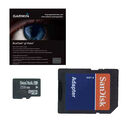
Perfect your boating adventures with detailed maps and local features like currents and fishing charts using Garmin’s BlueChart g2 HD cartography.
Garmin BlueChart g2 HD microSD cards give you quality coverage of your selected area and many useful features to give you total navigating confidence.
High accuracy of depth contours and surrounding waters will increase your situational awareness to help protect your boat (and its occupants) from the unexpected.
Coastal Features are visible from your display so that even in the worst of conditions you’ll know right where you are and what’s around you.
Local Information such as currents and anchorages is at your fingertips.
Fishing Charts give any angler an advantage – even in unfamiliar waters!
Coverage
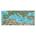
- Offshore coastal coverage of the Mediterranean Sea in its entirety;
- Includes: The Strait of Gibraltar; The Balearic Islands; The French Riviera; Corsica; Sardinia; Sicily; The Adriatic Sea; The Greek Islands; The Aegean Sea; The Dardanelles Strait; The Bosporus Strait; The Sea of Marmara; Cyprus; The Suez Canal; Tripoli and Algiers Harbors; The Gulfs of Gabès and Tunisia
Key Features
- Precision and Accuracy: View the exact position of your vessel, detailed coastal features, anchorages, obstructions, waterways, tidal stations, currents, and depth contours so you will always know precisely where you are and where you want to go.
- Fishing Features: Local fishing charts give even first-time visitors a local’s advantage.
- Safety in Visibility: This card includes local depth contours so you can feel confident navigating over any marine landscape.


