GPSMAP 1243 Multifunction Display, Non-Sonar with BlueChart G3 and LakeVu G3 Charts



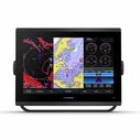

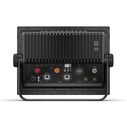
Get a sharper view from your connected helm with the GPSMAP® 1243 chartplotter.
Its high-resolution 12" in-plane switching touchscreen and ultrasleek design seamlessly integrate into your Garmin marine system, putting full control at your fingertips. Preloaded BlueChart® g3 coastal charts and LakeVü g3 inland maps give you the best of Garmin and Navionics® data — with built-in Auto Guidance technology for confidence in helping you get where you need to go. Easily build your marine system — from compatible sonar and autopilots to compatible radar, cameras and multimedia — using HTML 5.0, NMEA 2000® and NMEA 0183 network connectivity, J1939 for engines and the Garmin Marine Network. Add Panoptix™ FrontVü forward-looking sonar2 (sold separately) for help in avoiding underwater obstructions ahead. Or pair your plotter with your other compatible Garmin devices, such as quatix® marine smartwatches, wind transducers, wireless remote controls and more.
- New higher-resolution touchscreen displays offer improved sunlight readability and visibility
- Fast and responsive, with nearly twice the processing power of previous-generation GPSMAP® Plus devices
- Slimline display borders, edge-to-edge glass and reduced unit footprint make for easy retrofit in a wider range of dash configurations
- Preloaded mapping includes LakeVü g3 and BlueChart® g3 with the best of Garmin and Navionics® data plus built-in Auto Guidance technology for confidence in helping you get where you need to go
- Built-in Garmin SailAssist™ features, including laylines, race features, set and drift, wind data and more


