This product is not longer available, we recommend a similar product instead:
Clearance
GPSMAP 7612 Chartplotter with U.S. BlueChart g2 and LakeVu HD Inland Charts
Model #
17634106
Mfg #
010-01307-11
Orders placed by 3 PM EST typically ship the same day. Orders placed after this time will be processed the next business day.



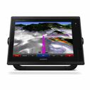
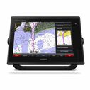
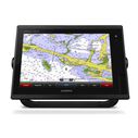
GPSMAP 7612 Chartplotter with U.S. BlueChart g2 and LakeVu HD Inland Charts
Model #
17634106
Mfg #
010-01307-11
Out Of Stock
Item out of stock get notified when back in stock:
Thank you!
We'll let you know when it's back in stock.
−
+
Designed for sportfishermen, cruisers, sailors and sailing racers who demand high performance, ease of operation and feature integration in a chartplotter.
The 12.1" diagonal multi-touch widescreen GPSMAP® 7612 chartplotter is fully network capable, including Garmin Network and NMEA 2000, and offers the conveniences of built-in Wi-Fi connectivity.
Plus it is also preloaded with premium mapping including both LakeVü HD with 17,000 lakes and BlueChart® g2 for the coastal US and Bahamas.
Key Features
- Preloaded BlueChart g2 maps: In addition to basic charts, tidal stations, currents, depth contours, IALA symbols and included fishing charts, BlueChart g2 offers smooth transitioning between zoom levels and more seamless continuity across chart boundaries. You can customize your screens with Safety Shading that allows you to shade all depth contours shallower than your boat’s safe depth. Fishing charts emphasize bathymetric contours with less visual clutter on the display. And there’s also a choice of standard 2-D direct overhead or 3-D “over-the-bow” map views for easier chart reading and orientation.
- Preloaded LakeVü HD Maps: These highly detailed freshwater maps include 17,000+ U.S. lakes, rivers and reservoirs. Included in those are more than 13,000 HD lakes with 1-foot contours shoreline to shoreline; excellent detail of underwater features plus Shallow Water Shading that allows you to designate a minimum depth; interstates, highways, general roads and bridges; designated fishing areas; and points of interest, such as docks, boat ramps, marinas and campgrounds. Garmin New Chart Guarantee
- Garmin Marine Network and NMEA 2000 Support: GPSMAP 7610xsv supports radar, autopilot, instruments, multiple screens, FUSION-Link, sensors, remote sonar modules, digital switching, thermal cameras, GRID rotary knob, joystick and keypad control, GXM™ 53 marine weather receiver and more.
- FUSION-Link Entertainment System: Enjoy the ability to control all compatible FUSION-Link-enabled audio systems directly from your compatible chartplotter display.
Specifications
- Display Type: Multi-touch widescreen LCD
- Screen Size: 12.1" diagonal
- Screen Resolution: 1280 x 800
- Included Cartography: BlueChart g2 coastal/LakeVü HD inland
- Optional Cartography: LakeVü HD Ultra with Max Def Lakes, BlueChart g2 Vision
- Receiver Type: High-sensitivity 10Hz WAAS GPS/GLONASS receiver
- Voltage: 10-32V DC
- NMEA Interface: NMEA 0183, NMEA 2000, Garmin Marine Network
What's in the Box
- GPSMAP 7612 preloaded with U.S. BlueChart® g2 and U.S. LakeVü™ HD
- Power/data cable
- NMEA 2000 drop cable
- T-connector
- Bail mount with knobs
- Flush mount kit
- Protective cover
- Documentation

Cancer and Reproductive Harm -
www.P65Warnings.ca.gov
Type
Chartplotter
Antenna
Internal GPS Antenna
Best Use
Cruising
Card Type
Garmin BlueChart
Cartography
US Coastal
,
US Inland
Compatibility
Radar
,
Sounder
,
Sonar
,
Weather
,
VHF
,
Stereo
,
Cameras
Mount Type
Bail
,
Flat
,
Flush
Resolution
1280 x 800
Type
Chartplotter
Voltage
10 to 30 Volts DC
Warranty
Two Years
Waterproof
Waterproof


