There’s an app for almost everything on the water, and fishing is no exception. The right fishing app can help you find productive water, review recent catch activity, check weather, save waypoints, study structure, plan routes and log what worked. No app replaces local knowledge, safe seamanship or time on the water, but these tools can make trip planning faster and more informed.
This list focuses on five useful fishing and boating apps with different strengths: community catch data, nautical charts, fish activity forecasts, weather and satellite imagery. Use one app for quick planning, or combine several to build a more complete picture before you launch.
- For the best way to know what's biting near you: Fishbrain
- For comprehensive nautical charts: Navionics
- For knowing when fish are most active: Fishing Points
- For hourly weather forecasts and alerts: The Weather Channel
- For free satellite imagery of any body of water in the world: Google Earth
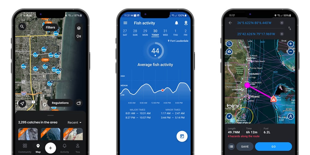
Fishbrain
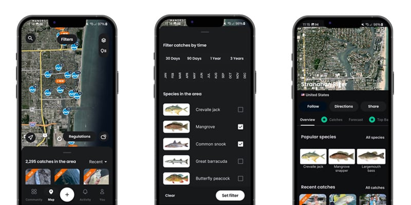
Top features: Fishbrain is a social fishing app that lets anglers post catches, photos, species information and locations that other anglers can view and filter. Trying to find where a certain species is biting? Zoom in on your area in the map, filter by species and review recent catches to find a starting point. The app also includes weather and fishing tools that can help with planning.
Best use: Fishbrain is most useful when you want recent, crowd-sourced fishing information. It can help identify active lakes, shore spots, species patterns and popular baits in your area. Treat the data as a clue, not a guarantee. Catch reports depend on what other anglers choose to share, and some productive spots may be hidden, delayed or intentionally vague.
How much does Fishbrain cost? The base version is free. Fishbrain Pro adds advanced features such as detailed fishing maps, premium forecast tools and additional catch insights. Fishbrain lists Pro at $12.99 monthly or $79.99 annually, which works out to about $6.69 per month when billed annually. Pricing can change by platform, promotion and location. :contentReference[oaicite:0]{index=0}
Navionics
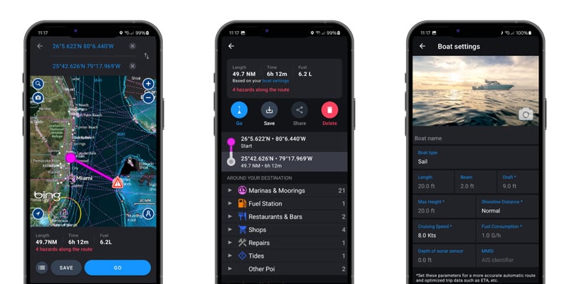
Top features: The Navionics app puts detailed nautical charts in the palm of your hand. It is useful for boating, fishing, sailing and cruising because it supports offline chart use, route planning and marine map details. For anglers, the value is in reading depth changes, channels, contour lines, edges, flats, points and other structure before and during a trip.
Best use: Navionics is strongest when navigation and bottom structure matter. It is a smart choice for anglers running unfamiliar water, fishing offshore, navigating channels, planning lake routes or studying depth changes before a trip. It should supplement, not replace, safe navigation practices, onboard electronics and local conditions.
How much does the Navionics app cost? Navionics Boating offers a limited free trial, and continued use of charts and advanced features requires a yearly auto-renewable subscription. Pricing varies by region and platform, so confirm the current cost for your chart region before subscribing. :contentReference[oaicite:1]{index=1}
Fishing Points
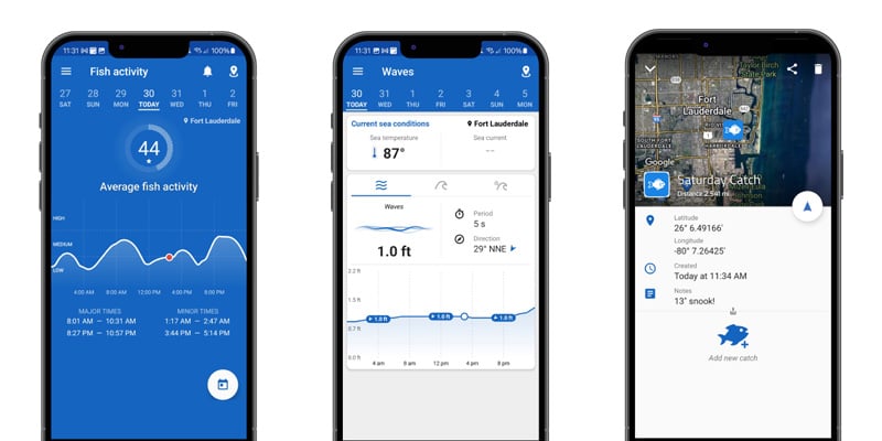
Top features: Fishing Points is an all-in-one fishing forecast app that provides fish activity ratings, nautical maps, tides, weather, moon and sun data, waypoints and a way to log and save locations and pictures of catches. It is useful for both saltwater and freshwater anglers.
Best use: Fishing Points is helpful when you want to combine planning and logging in one place. Use it to mark productive spots, record catch details, review tides and solunar activity, and plan return trips based on what worked. It is especially useful for anglers who like to build a personal fishing history over time.
How much does Fishing Points cost? Fishing Points offers core features at no cost, with optional Premium upgrades for advanced features. The developer notes that Premium pricing can vary by location and platform, so confirm the current subscription price in your app store before upgrading. :contentReference[oaicite:2]{index=2}
The Weather Channel
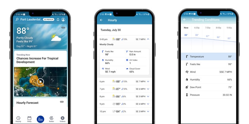
Top features: The Weather Channel app can be a major help when planning a day on the water. Even though many fishing apps include weather data, it is smart to cross-check conditions with a dedicated weather app. Wind direction, gusts, radar, lightning alerts, rain timing and storm movement can all affect whether a fishing trip is safe or productive.
Best use: Use The Weather Channel for general weather awareness, hourly forecasts, radar and push alerts. Before boating offshore, crossing open bays or running long distances, compare it with marine-specific forecasts, NOAA weather radio and local conditions. A land-based weather forecast may not fully represent wind, waves, current or storm development over open water.
How much does The Weather Channel app cost? The Weather Channel app can be used for free with ads. Weather.com also offers optional Premium subscriptions with additional features, with Weather Premium listed at $29.99 per year after a free trial. Pricing and available features can vary by platform. :contentReference[oaicite:3]{index=3}
Learn More and Download for iOS >
Learn More and Download for Android >
Google Earth
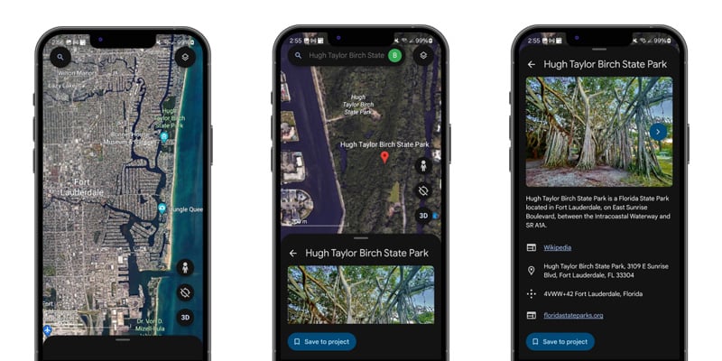
Top features: Google Earth is often overlooked but is an incredibly powerful scouting tool for anglers. Fishing a new lake, river, marsh or shoreline for the first time? Pull it up in Google Earth and look for points, drains, cuts, channels, docks, grass edges, sandbars, creek mouths and other structure that can hold fish.
Best use: Google Earth is especially helpful when historic imagery reveals low-water structure that is now submerged. Brush piles, ditches, rock lines, oyster bars, shallow flats and old roadbeds may be visible in older imagery and hidden under current water levels. Save promising areas before the trip, then compare them with charts, tide data and local regulations.
How much does Google Earth cost? Google Earth is free to use.
Learn More and Download for iOS >
Learn More and Download for Android >
How to Use Fishing Apps Together
The strongest approach is to combine apps instead of relying on one source. Use Google Earth to scout structure before the trip, Navionics to understand charts and safe routes, Fishbrain to review recent catch patterns, Fishing Points to check tides and fish activity, and The Weather Channel to monitor changing weather. When several tools point to the same area or pattern, you have a stronger starting plan.
Apps are planning aids, not guarantees. Conditions on the water change quickly, and fish respond to weather, tide, pressure, water clarity, bait movement, temperature and angling pressure. Always verify conditions at the ramp, carry required safety gear and use your own judgment.
Fishing App FAQ
What is the best fishing app for finding where fish are biting?
Fishbrain is useful for recent catch reports and species filtering because it is built around community-submitted catches. It can help identify active areas, but it should be used with local knowledge and current conditions.
What is the best fishing app for nautical charts?
Navionics is the strongest choice in this list for nautical charts, route planning and depth contour review. It is especially useful for boaters and anglers running unfamiliar water.
Are fishing forecast apps accurate?
Fishing forecast apps can help identify better time windows, but they cannot guarantee success. Solunar data, weather, tide and pressure are useful inputs, but local bait movement, water clarity and fishing pressure also matter.
Can I use Google Earth for fishing?
Yes. Google Earth is a strong scouting tool for finding structure, shoreline changes, low-water features, grass lines, channels and access points before a trip.
Should I pay for a fishing app subscription?
Pay for a subscription only if the premium features match how you fish. Anglers who need detailed maps, saved waypoints, catch history, advanced forecasts or offshore planning tools may benefit more than casual anglers who only need basic weather and scouting.
With these apps you have a ton of information in the palm of your hand. All that’s left to do is get out there, start casting and catch something.
Need More Help?
West Marine is the perfect place to get ready for your next fishing trip. We offer free line spooling and locally assorted tackle in most of our stores to gear you up for what’s biting in your area. Plus, with a huge selection of fishing gear and plenty of anglers on our crew, we have the know-how you need to get ready. Find your store here.
Related: