MSD/NAV+30XG/ROW Africa & Middle East




Complete Your Purchase


Navionics MSD/NAV+30XG/ROW Africa & Middle East
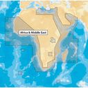
The Navionics+ MSD/NAV+30XG/ROW Africa & Middle East microSD Card provides Nautical Charts, SonarCharts, and Community Edits on one card. This electronic navigation chart delivers everything you need for confident marine navigation across a comprehensive coverage area including Western Sahara, Mauritania, Senegal, Gambia, Guinea Bissau, Guinea, Sierra Leone, Liberia, Ivory Coast, Ghana, Benin, Nigeria, Cameroon, Gabon, Congo, Angola, Namibia, South Africa, Tanzania, Kenya, Somalia, Madagascar, Comoros, Aldabra Islands, Seychelles, Socotra, Lake Kariba, Red Sea, Persian Gulf, Cape Verde Islands, Gulf of Guinea, Gough Island, Tristan da Cunha, Gulf of Oman, Gulf of Aden, and major port cities including Alexandria Egypt, Djibouti, Manama Bahrain, Dubai, Cape Town South Africa, and Lagos Nigeria.
Key Features
- All-in-one max detailed cartography for marine and lakes
- Exclusive high-definition SonarChart with 1 ft HD bathymetry mapping
- Community Edits from Navionics app users worldwide
- Boat safer with accurate navigational data for your GPS plotter
- Fish smarter with enhanced local content
- Get the most out of your time on the water
- Freshest Data service with daily updates
- Download Freshest Data free for one year
- Upload your sonar logs to improve charts in your area
- Thousands of edits made daily to ensure current chart accuracy
- Compatible with multiple chartplotter brands
- microSD format for broad device compatibility

You May Also Like


