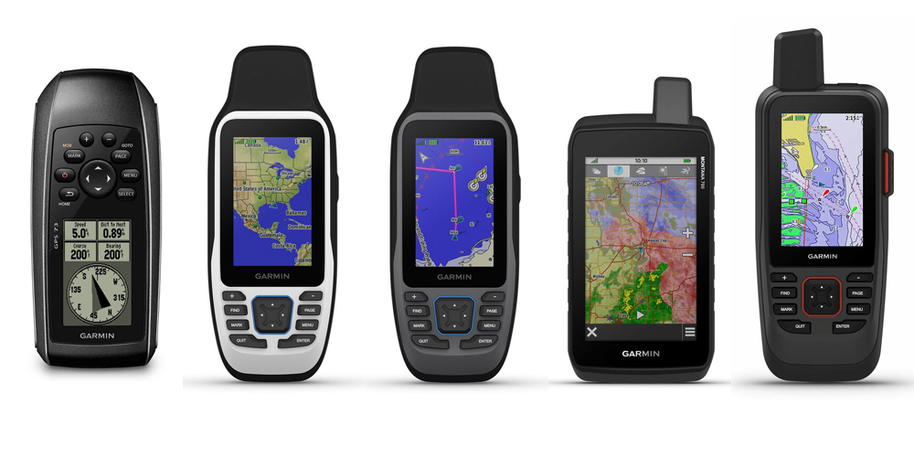
When it comes to navigation, a reliable handheld GPS can be an invaluable tool. Whether used as a backup to a chartplotter or as a stand-alone device, our top handheld GPS picks feature models with a wide range of capabilities, making them ideal for a variety of activities. From marine navigation and coastal exploration to outdoor adventures, these devices provide precision, durability, and features that cater to different needs, ensuring you’re always on the right path.
- For an entry-level handheld with sailing features: GARMIN GPS 73 Handheld GPS Navigator
- For a sunlight-readable, high-resolution color display: GARMIN GPSMAP® 79s Handheld GPS
- For a reliable handheld for coastal navigation: GARMIN GPSMAP® 79sc Handheld GPS
- For hikers, hunters, and marine adventurers: GARMIN Montana® 700 Handheld GPS
- For advanced navigation and communication features: GARMIN GPSMAP® 86sci Handheld GPS
- Conclusion
- Handheld GPS FAQs
- We're Here to Help!
- Related Articles
- Browse All Marine Electronics & Navigation Gear
GARMIN GPS 73 Handheld GPS Navigator
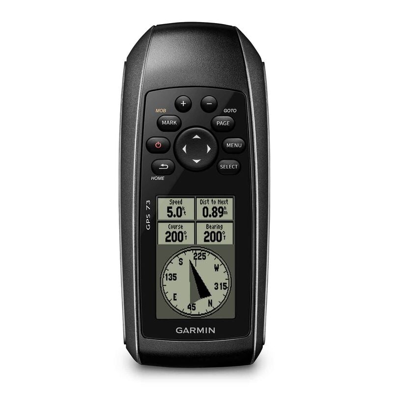
About this GPS:
The Garmin GPS 73 is an easy-to-use, versatile handheld GPS navigator designed for small watercraft, including runabouts and sailboats, without a chartplotter. It’s also an excellent emergency backup for any vessel. The intuitive user interface, with dedicated backlit buttons, ensures ease of operation in all lighting conditions. Equipped with a high-sensitivity receiver, it locks onto GPS signals quickly and tracks your location even in challenging environments like deep canyons or under heavy tree cover. With SailAssist features, such as tack assist, countdown timers, and virtual starting line, it’s a perfect companion for sailing enthusiasts. Plus, it floats, making it ideal for marine use.
Who Can Benefit:
Ideal for boaters and sailors who need a reliable backup GPS with sailing-specific functions.
Why We Like It:
Its long battery life, floating capability, and high-sensitivity receiver make it perfect for use in any conditions, while the SailAssist features provide extra help on the water.
GARMIN GPSMAP® 79s Handheld GPS
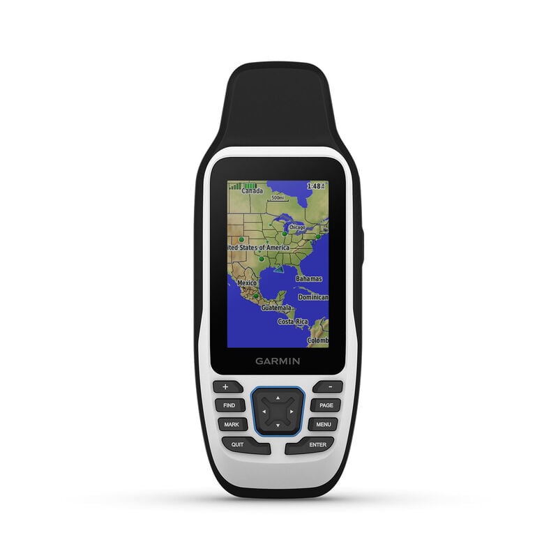
About this GPS:
The Garmin GPSMAP® 79s is a rugged, floating handheld GPS designed for marine use. It features a sunlight-readable, high-resolution color display, ensuring clear visibility in all conditions. With support for multiple satellite constellations (GPS, GLONASS, Beidou, Galileo, QZSS, and SBAS), it delivers reliable tracking worldwide. This GPS includes a built-in compass and offers increased memory to store and track up to 10,000 waypoints and 250 routes.
Who Can Benefit:
Perfect for sailors and boaters who need an all-weather handheld GPS with expanded storage for waypoints and routes.
Why We Like It:
Its durability, large memory capacity, and global satellite support ensure reliability in a variety of environments.
GARMIN GPSMAP® 79sc Handheld GPS
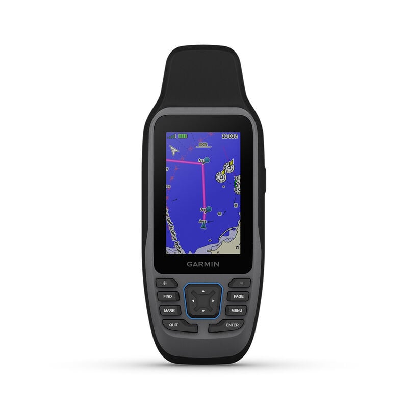
About this GPS:
The Garmin GPSMAP® 79sc is built for life on the water with a rugged, floating design and a high-resolution, scratch-resistant, fog proof display. It offers access to multiple satellite constellations and features preloaded BlueChart® g3 coastal charts. Features include storage for up to 10,000 waypoints and 250 routes, and a built-in 3-axis electronic compass to keep you oriented even when stationary.
Who Can Benefit:
Ideal for boaters who frequently navigate coastal waters and require detailed, reliable charts for navigation.
Why We Like It:
The preloaded BlueChart® g3 charts and marine-specific design make it a useful tool for coastal navigation.
GARMIN Montana® 700 Handheld GPS
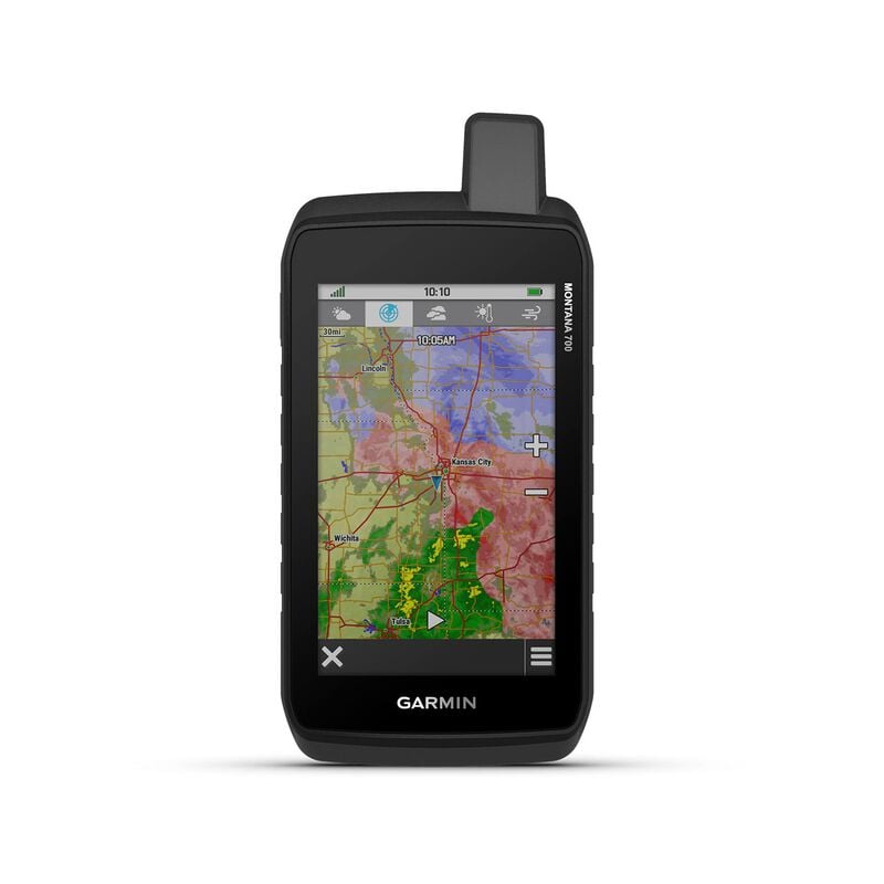
About this GPS:
For outdoor enthusiasts seeking versatility, the Garmin Montana® 700 is the perfect choice. Featuring a 5" glove-friendly touchscreen, it’s ideal for navigating both on and off the water. With multi-GNSS support, preloaded TopoActive maps, 3-axis compass and a barometric altimeter, the Montana® 700 provides reliable outdoor navigation, whether you’re hiking, biking, or kayaking. It also features wireless connectivity, allowing for BirdsEye Satellite Imagery downloads, location sharing, and more.
Who Can Benefit:
Great for hikers, hunters, and marine adventurers who want a rugged GPS with comprehensive mapping capabilities.
Why We Like It:
With a large, easy-to-read display, rugged construction, and multi-sport functionality, this is one of the most versatile handheld GPS available today.
GARMIN GPSMAP® 86sci Marine Handheld with BlueChart® g3 and inReach® Capabilities
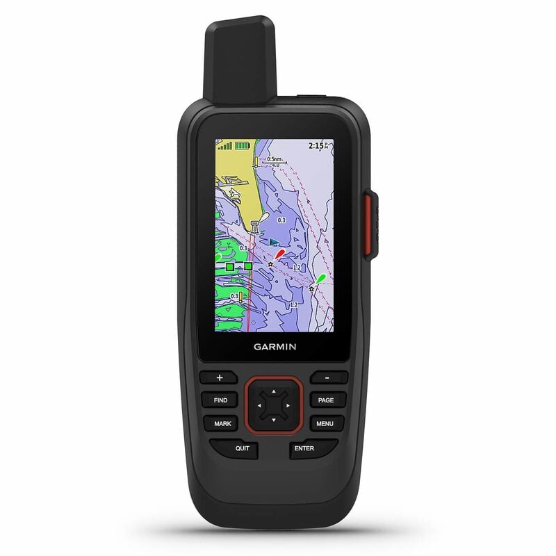
About this GPS:
The Garmin GPSMAP® 86sci is a premium handheld GPS for marine use, offering a floating, water-resistant design with a 3" color display that’s easily readable in sunlight. It comes with preloaded BlueChart® g3 coastal charts for detailed and accurate navigation. InReach® satellite communication enables two-way texting, tracking, and SOS alerts, providing peace of mind wherever your adventures take you. The GPSMAP® 86sci also integrates seamlessly with compatible Garmin chartplotters and instruments.
Who Can Benefit:
Perfect for serious boaters who require advanced navigation and communication features, including satellite connectivity.
Why We Like It:
The combination of BlueChart® g3 charts, satellite messaging, and long battery life make this a top choice for marine navigation and safety.
Conclusion
Each of these handheld GPS devices offers unique features tailored to different types of outdoor and marine adventures. Whether you're sailing the open sea, hiking through rugged terrain, or simply need a reliable navigation backup for your boat, one of these devices will suit your needs.
Happy trails and steady she goes!
Handheld GPS FAQs
What are the key benefits of using a handheld GPS?
A handheld GPS provides reliable navigation in areas where cell service is unavailable. It offers precise location tracking, waypoint marking, route planning, and, in some models, marine and topographic maps. Many are waterproof, rugged, and designed for outdoor use, making them ideal for boating, hiking, and backcountry navigation.
How does a handheld GPS compare to a smartphone for navigation?
Unlike smartphones, which rely on cellular networks, handheld GPS devices use satellite signals for location tracking, ensuring reliable performance even in remote areas.
What features should I look for in a handheld GPS for boating?
For marine use, look for a GPS with that is waterproof, buoyant, high-sensitivity satellite reception, and marine-specific charts like BlueChart® g3. Depending on your needs, other features to look for include a built-in compass, barometer, and wireless connectivity for enhanced navigation and safety.
Can a handheld GPS be used as a primary navigation device on a boat?
Yes, a handheld GPS can serve as a primary navigation tool, especially for kayaks or small boats that don't have the space for a fixed-mount chartplotter.
How long does the battery last on a handheld GPS?
Battery life varies by model but typically ranges from 10 to 35 hours on standard AA batteries or rechargeable lithium-ion packs. Power-saving features, such as battery saver modes and backlight adjustments, can help extend usage.
Do handheld GPS devices require a subscription or internet connection?
Most handheld GPS units work without a subscription, as they connect directly to satellite systems for location tracking. However, models with satellite communication features (such as the GARMIN GPSMAP® 86sci that includes inReach® Capabilities) do require a subscription for messaging, SOS alerts, and weather updates.
We're Here to Help!
With over 230 stores, the world's best selection of boating products, great customer service and expertise to match, West Marine has more of what you need for great days on the water. Order online or use our store locator to find the West Marine store nearest to you.
Related Articles
Browse All Marine Electronics & Navigation Gear
- Chartplotters, GPS units, radar systems, and integrated navigation displays
- Sonar, CHIRP, downscan, and fish-finding electronics
- Marine stereos, speakers, amplifiers, and audio accessories
- VHF radios, AIS, satellite communication equipment
- Autopilot systems and steering control components
- Wind, depth, speed, and multifunction instruments
- Marine binoculars for navigation and low-light use
- Thermal and night-vision devices for situational awareness
- Onboard monitoring and security systems
- Magnetic and electronic compasses
- Paper and electronic navigation charts
- Regional cruising and harbor guides
- Traditional navigation plotting tools