This product is not longer available, we recommend a similar product instead:
Clearance
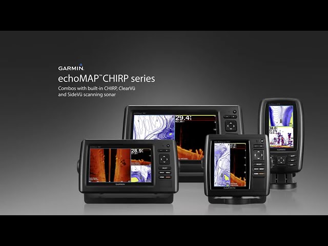
echoMAP® 74dv Fishfinder/Chartplotter Combo with Sonar Capability and BlueChart g2 Coastal Charts
Model #
17987991
Mfg #
010-01810-00
Orders placed by 3 PM EST typically ship the same day. Orders placed after this time will be processed the next business day.
Get 5X West Advantage Points on all purchases for a limited time! Not a rewards member? JOIN NOW


echoMAP® 74dv Fishfinder/Chartplotter Combo with Sonar Capability and BlueChart g2 Coastal Charts
Model #
17987991
Mfg #
010-01810-00
Out Of Stock
Item out of stock get notified when back in stock:
Thank you!
We'll let you know when it's back in stock.
−
+
7-inch combo with great features for the money.
The easy-to-install, easy-to-use echoMAP® 74dv includes a 7" diagonal high-contrast color display with automatic backlight adjustment. It supports Minn Kota® and MotorGuide® trolling motors with integrated transducers. Internal 5Hz GPS/GLONASS updates position and heading five times per second. The combo's cords plug directly into the mount, allowing you to quickly install and remove your device from power and the mount. Transducer is sold separately.
Key Features
- Clearest scanning sonar on the water: DownVü scanning sonar gives you a nearly photographic image of what passes below your boat. You clearly see structure, submerged objects and fish. Traditional Garmin HD-ID sonar and DownVü scanning sonar are combined into one transducer (Garmin GT21-TM Transducer, sold separately). Also provides HD-ID support for Minn Kota and MotorGuide trolling motors with integrated transducers.
- Sonar recording: EchoMAP 74dv also includes sonar-recording capability that coordinates the timing of the sonar return with your boat's position and saves digital information for playback on a computer using free HomePort™ planning software. Use the user data sharing cable to share waypoints and routes between multiple devices.
- Preloaded BlueChart g2 Maps: EchoMAP 74dv comes preloaded with BlueChart g2 maps covering the coastal U.S. and Bahamas (east coast, west coast, Gulf of Mexico, U.S. side of the Great Lakes). It also includes all charts for the U.S. coastline and the Bahamas as well as everything available on NOAA charts. In addition to the basic charts, tidal stations, currents, depth contours, IALA symbols and included fishing charts, BlueChart g2 offers smooth transitioning between zoom levels and more seamless continuity across chart boundaries. You can customize your screens with Safety Shading which allows you to contour shade for all depth contours shallower than what you determine is your safe depth. Fishing charts emphasize bathymetric contours with less visual clutter on the display. And there's also a choice of standard 2-D direct overhead or 3-D "over-the-bow" map views for easier chart reading and orientation.
- Heading and position refreshed five times per second: Fast, responsive 5Hz GPS/GLONASS refreshes your position and heading five times each second to make your movement on the screen more fluid. It makes dropping up to 5,000 accurate waypoints and finding your way back to your secret fishing hot spots quick and easy.
- Take echoMAP with you: When you're off the water, it's easy to keep your echoMAP safe and secure. You don’t have to mess with plugging and unplugging wires from the unit because the cables plug directly into the mount. This allows you to quickly install and remove your echoMAP from power and the mount.
- Upgrade with the best Garmin maps on the water: A single microSD™ card slot provides expandable memory for accessory map purchases such as, LakeVü HD, LakeVü HD Ultra or BlueChart® g2 Vision®. LakeVü HD Ultra and BlueChart g2 Vision provide exclusive Garmin Auto Guidance that directs you right to your hot spots by instantly creating an on-screen path based on your boat’s specifications that you can follow to avoid shallow water and other charted obstructions.
- Enhanced Auto Guidance: Just enter the location where you want to go and patented Garmin Auto Guidance technology instantly searches through relevant charts to create a safe virtual pathway on the display that helps you avoid low bridges, shallow water and other charted obstructions en route.
- Create your own HD maps: Quickdraw Contours is a free, easy-to-use software feature that is already installed on your compatible Garmin device. It instantly creates your very own personalized HD fishing maps with 1-foot contours. Tailor them to fit your needs. They are your maps. You own them. Keep the data to yourself or share it with Garmin or your friends. There’s no special surveying expertise required. You just fish while it creates maps. You don’t have to wait around or send your files away like other mapping software requires — your results appear instantly. Use with any Garmin Panoptix™, any HD-ID™, any CHIRP-enabled, Garmin DownVü transducer or NMEA 2000®-compatible depth transducer. Have more than 1 sonar device installed onboard? Quickdraw Contours automatically selects the most capable sonar device to provide the very best results for you!
- Multiple Depth Range Shading: Designate up to 10 different depth ranges each with its own color. Makes it easier to view target depths at a glance.
Specifications
- Screen Size: 7" diagonal
- Screen Resolution: 480 x 800
- Included Cartography: US Coastal BlueChart g2
- Receiver Type: 5Hz internal GPS/GLONASS
- Transmit Power: 500W (RMS)
- Transducer: Sold separately
- Dimensions: 9 13/16"W x 5 1/2"H x 2"D
- NMEA Interface: NMEA 0183
- Waterproof Rating: IPX7
- Warranty: One year

Type
Fishfinder/Chartplotter Combo
Cartography
BlueChart g2 US Coastal
Diagonal Screen Size
7 Inches
Dimensions
9 3/4" Width x 5 1/2" Height x 2" Depth
Display Color
Color
Display Shape
Horizontal
Display Type
Color WVGA
Frequency
50/77/200kHz
GPS
Internal GPS Antenna
Maximum Depth
2300' (Fresh)
,
1100' (Salt)
Mount Type
Flush
,
Tilt & Swivel
,
Quick Disconnect
Resolution
480 x 800
Sonar
Down Imaging
,
Multi Frequency
,
Side Imaging
Specific Transducer
Transducer not Included
Transmit Power
500 Watts (RMS)
Type
Fishfinder/Chartplotter Combo
Warranty
One Year
Waterproof
Waterproof


