echoMAP CHIRP 54dv Fishfinder/Chartplotter with GT23-TM ClearVü/CHIRP Transducer and BlueChart® g2 Charts
Get 5X West Advantage Points on all purchases for a limited time! Not a rewards member? JOIN NOW


The Garmin echoMAP CHIRP 54dv gets you fishing with the power of CHIRP sonar. The easy-to-install, easy-to-use 5-inch echoMAP CHIRP 54dv includes a transducer for high wide CHIRP sonar and Garmin CHIRP DownVü, the clearest scanning sonar on the water. Quickdraw Contours software allows you to instantly create your own HD maps with 1-foot contours as you fish. Internal 5 Hz GPS updates position and heading 5 times per second. It even provides NMEA 2000 support for engine data, sensors, autopilots and more. Cords plug directly into the mount, allowing you to quickly install and remove your device from power and mount. Transom and trolling motor mounts included.
Garmin 010-01568-01 echoMAP CHIRP 54dv Features:
- 5-inch color display with keypad control
- Includes GT23M-TM transducer with Mid-Band CHIRP
- Preloaded BlueChart g2 charts for the coastal U.S.
- Includes Quickdraw Contours custom HD map creation software
- Internal 5 Hz GPS updates position and heading 5 times per second
The Garmin CHIRP Difference
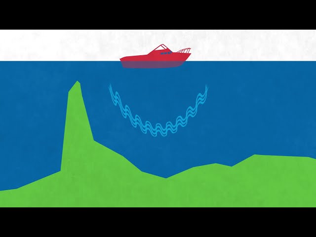
The built-in sonar capabilities of echoMAP 54dv include CHIRP sonar, the most sophisticated sonar technology available for the fishing and boating public. CHIRP sonar provides amazingly clear target separation and definition because it puts even more energy onto the target than traditional sonar. It also includes sonar-recording capability that coordinates the timing of the sonar return with your boat's position and saves digital information for playback on a computer using HomePort planning software. Use the user data sharing cable to share waypoints and routes between multiple devices.
Clearest Scanning Sonar on the Water
Garmin CHIRP DownVü scanning sonar gives you a nearly photographic 750 feet below your boat. You clearly see structure, submerged objects and fish Traditional Garmin HD-ID sonar and DownVü scanning sonar are combined into 1 transducer. Also provides HD-ID support for Minn Kota and MotorGuide trolling motors with integrated transducers.
Preloaded BlueChart g2 Maps
echoMAP 54dv is preloaded with BlueChart g2 maps covering the coastal U.S. (East Coast, West Coast, Gulf of Mexico, U.S. and Canadian sides of the Great Lakes). It also includes all U.S. charts for the entire coastline as well as everything available on NOAA charts. In addition to the basic charts, tidal stations, currents, depth contours, IALA symbols and included fishing charts, BlueChart g2 offers smooth transitioning between zoom levels and more seamless continuity across chart boundaries. Customize your screens with Shallow Water Shading, which allows you to contour shade for all depth contours shallower than what you determine is your safe depth. Fishing charts emphasize bathymetric contours with less visual clutter on the display. And there's also a choice of standard 2-D direct overhead or 3-D "over-the-bow" map views for easier chart reading and orientation.
Create Your Own HD Maps
Quickdraw Contours is a free, easy-to-use software feature already installed on your echoMAP CHIRP 54dv. It instantly creates your own personalized HD fishing maps on screen with 1-foot contours. Tailor the maps as needed; you own them. Keep the data for yourself, or share it with Garmin or your friends. No special surveying expertise is required. You just fish while Quickdraw Contours creates maps. There's no waiting around or sending your files away like other mapping software requires - your results appear instantly. Use with any Garmin Panoptix transducer, any HD-ID sonar, any CHIRP-enabled, Garmin DownVü transducer or NMEA 2000-compatible depth transducer. Have more than 1 sonar device installed onboard? Quickdraw Contours automatically selects the most capable sonar device to provide the very best results for you.
Heading & Position Refreshed 5 Times Per Second
Fast, responsive 5 Hz GPS/GLONASS refreshes your position and heading 5 times each second to make your movement on the screen more fluid. Now it's quick and easy to drop up to 5,000 accurate waypoints and find your way back to your secret fishing hot spots.
Take Your echoMAP with You
When you're off the water, it's easy to keep your echoMAP safe and secure. You don't have to mess with plugging and unplugging wires from the unit because the cords plug directly into the mount. This allows you to quickly install and remove your echoMAP from power and the mount.
Enhanced Auto Guidance
Just enter the location where you want to go and Garmin Auto Guidance technology instantly searches through relevant charts to create a safe, virtual pathway on the display that helps you avoid low bridges, shallow water and other charted obstructions en route.
GPX Waypoints Transfer
If you have waypoints, tracks or frequently used routes stored on another manufacturer's GPS product - or on a Garmin handheld device - now it's easier than ever to transfer those items to your new Garmin chartplotter, via industry-standard GPX software formatting. GPX is an open standard format for GPS data exchange across platforms and applications. With this easy-to-use interface technology, Garmin has taken "no waypoint left behind" to a whole new level of trade-up convenience.
Transducer Options:
You may want to consider these transducer options, sold separately. Depending on the style of the transducer, you'll get depth, speed and/or temperature readings.
| Transducer Type: CHIRP | Reading(s) | Power | Depth | Material | Model |
|---|---|---|---|---|---|
| GT20-TM Traditional/ClearVu Transom Mount (4 pin)(Primary) | Depth/Temp | 500W | 1,900' Traditional 750' ClearVu | Plastic | 17596289 |
| GT20-TM Traditional/ClearVu Transom Mount (8 pin) | Depth/Temp | 500W | 1,900' Traditional 750' ClearVu | Plastic | 17492372 |
| GT21-TM Traditional/ClearVu Transom Mount (8 pin)(Primary) | Depth/Temp | 600W Traditional 500W ClearVu | 1,500' Traditional 1,000' ClearVu | Plastic | 17596297 |
| GT21-TH Traditional/ClearVu Thru-Hull (8 pin)(Primary) | Depth/Temp | 600W Traditional 500W ClearVu | 1,500' Traditional 1,000' ClearVu | Plastic/Stainless Steel | 17596305 |
| GT30-TM ClearVu/SideVu Transom Mount (12 pin) | Depth/Temp | 500W | 750' ClearVu 1000' SideVu | Plastic/Stainless Steel | 17596313 |
| GT30-TH ClearVu/SideVu Thru-Hull (12 pin) | Depth/Temp | 500W | 1000' ClearVu 750' SideVu | Plastic/Stainless Steel | 17596321 |
| GT30-THP ClearVu/SideVu Thru-Hull (12 pin), Pair | Depth/Temp | 500W | 1000' ClearVu 1000' SideVu | Plastic/Stainless Steel | 17596339 |


